Geography

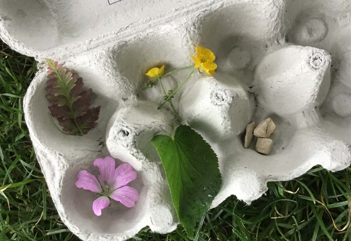
FS2 Nature Treasure Chests

What a magical time we have had this week in outdoor learning. Children had to hunt high and low for natures treasures on our school grounds and found some really interesting things. Off we went with our treasure chests (egg boxes) which we filled with: snail shells, baby conkers, apple babies, cherry babies, catkins, beech […]

FS2 Orienteering (outdoor learning)

This week children in FS2 had the opportunity to try orienteering. We had to put our map reading skills to the test and communicate effectively for this task. Children hunted for coloured flags around the school grounds, using numbers on a map to help them. We were really impressed with their determination to complete the […]

Y4 Visit to Burbage Valley

To support our learning in Geography of maps and settlements, and History about Roman roads and bridge-making, Y4 hiked from Ringinglow along the Houndkirk Road, then down through Burbage Valley across the packhorse bridge and up to Carl Wark and then Higger Tor. Whilst walking, we investigated why some people think that the Houndkirk Road […]

Schools Climate Emergency South Yorkshire Conference

Children from Dore Primary School took part in the 3rd South Yorkshire schools’ climate action conference in March. This important conference was very popular so only six places were available to us. Children were asked to send in their pitch, (either written or by video message) for why they should get a place. Mrs Simpson […]

Pre-School Fairtrade

As it’s Fairtrade Fortnight, on Monday we learned about where our food comes from and what it means if it is Fairtrade. We looked at the logo and explored the journey of a banana. We went in the hall and made the journey of a banana. The children were banana trees, chopped down, transported, put […]

Y2 – Local History and Geography

Today in Y2, the children have been studying the geographical changes in Dore since 1890. We identified that human features have changed the most, mainly the amount of houses built in the locality. We are creatively representing the changes we have discovered over time, as an aerial map.

Y5 Geography – Map Symbols

  Y5 have continued their Out and About Learning Journey by learning about map symbols, how they are used to mark features on maps and how they can be useful for interpreting maps and for planning or following a route. The children began by looking at different maps and getting to grips with the Ordnance […]